| Most viewed |
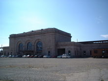
Oakland_16th_Street4506 views16th Street Station as of 8/2/2003. Elevated structures are still in place, but the tracks have long since been removed.
|
|
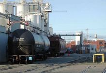
LSI4481 viewsAt 65th St. in Emeryville, this is the look of the former Red Train route just a few years ago. The cars are spotted at the LSI plant. A hopper car is rare here, usually just corn syrup tanks. Although most of the tracks still exist as of this date (12/7/
|
|
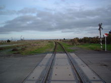
Subway_Undercrossing_Approach_Track_McAvoy_Road4481 viewsThis is the approach track to the West Pittsburg Subway. The photo was taken from MacAvoy Road. Note the newly installed concrete crossing.
|
|
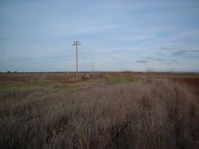
Mallard_ferry_landing_approach_track_Looking_Northeast4470 viewsThis is the approach track to the ferry slip at Mallard. Because the ferry slip burned, the tracks do not continue much further than this point.
|
|
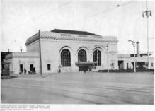
westernarc7_17_24453 viewsWestern Architect Magazine July 1917 16th St. SP station.
|
|
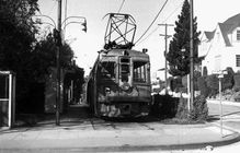
Key1874448 viewsKey System "C" train lays over the Oakland Ave. and Latham Sts. in Piedmont, the end of the line. Courtesy of John Stashik
|
|
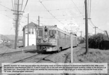
Key129_A_Twr24430 views"A" train at Tower 2 John Stashik Collection
|
|
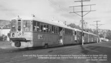
Key1224411 viewsKey System A-line at Havenscourt Courtesy of John Stashik
|
|
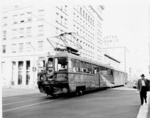
Key118_12_Bway4396 viewsEastbound "A" train crosses Broadway on 12th St. in downtown Oakland. April 15, 1958. John Stashik Collection
|
|
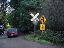
SN_Crossbuck_Canyon4395 viewsThis is a replica of a crossbuck that once stood at this location in Clyde. At the foot of the crossbuck is the base of a wig-wag signal which used to stand here.
|
|
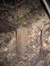
marker4386 viewsFor so few remnants of the SN, I was excited to see this. I don't know what it was, but it looks like some kind of mileage marker or something. The top has a bevel so it appears that this was the correct height. The top is roughly 2 feet above the roadbed
|
|
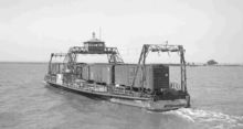
SNRRferryRamon4386 viewsSN Ferry Ramon leaving the pier at Mallard. 1946-47 Courtesy of W.T. Larkins
|
|
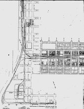
SN_Waterfront_Map_Sacramento4381 viewsThis is a map of all SN rail lines and spurs on the Sacramento waterfront. The map is from the Yahoo! SN group.
|
|
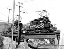
SNRR661atchabot4381 viewsFreight motor 661 heading west at Chabot. 1946-47 Courtesy of W.T. Larkins
|
|
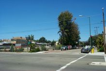
40th_and_Shafter4378 views40th and Shafter today
|
|
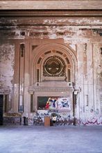
21_G4335 viewsAnother interior shot of the Main waiting area. Photo by Evan
|
|
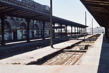
24_G4304 viewsUpper platform, looking south Photo by Evan
|
|
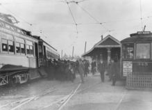
Key_PopJunc4295 viewsPoplar Junct., Oakland. Key shuttle car from 12th St. meets a 22nd St. line train bound for the pier. John Stashik Collection
|
|
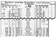
table_5_1_284293 viewstable.5.1.28 Courtesy of John Stashik
|
|
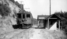
00_274290 viewsTrain 27. Last revenue passenger train to run over the line. 7-12-41. First station built by local residents to replace flag stop. Note unique design compared to other SN structures. Photo courtesy of Vernon Sappers
|
|
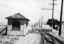
Sacramento_Northern_Ohmer_Flagstop_0164274 viewsThis is the Ohmer flagstop, located near the present North Concord BART station. This point is roughly half-way between Concord and Clyde.
|
|
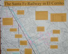
ecN4251 viewsEl Cerrito, northern part. Blue lines show tracks; pink notes rail customers. The Oakland line was abandoned in May 1979; most of the spurs were long gone before that. Courtesy of Tom Pana
|
|
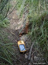
oldrail4244 viewsThis was an old piece of rail I found off the side of the trail. I don't know my guages, but you can see the scale with my GPS (about the size of a cell phone) right next to it.
|
|
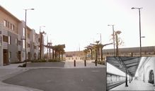
New Life for SP platform overhangs4239 views
|
|
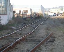
LSI_lead4213 viewsLong ago this was the Ninth Street Red Train route. Up until a few years ago this was the lead to LSI in Emeryville. Scene looking east from Powell St. These tracks still exist as of this date (12/7/02). LSI is now gone. Courtesy of John Stashik
|
|
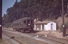
Havens_Station_19554212 viewsA view of Havens Station, near the west portal of the tunnel.
|
|
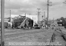
Demolition of 40th & Shafter Yards4189 viewsSacramento Northern's 40th & Shafter yard in Oakland, Califr being torn down, 1957. View faces 40th & Opal Streets. John Harder photo. Thanks to Key Route Ken for sending me this great shot
|
|
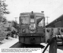
Key1724175 viewsKey System, F-line, Berkeley Courtesy of John Stashik
|
|
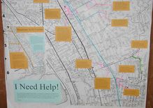
ecS4166 viewsEl Cerrito, southern part. Shows Santa Fe line with customers and spurs. Line was abandoned May 1979; most of the spurs were gone long before that. Courtesy of Tom Panas
|
|
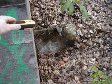
railrebar4160 viewsIn a few places it looked like some of the rail was used as concrete reinforcement. All the rail I found on my hike today was different guages. This one here was very small. I'd say about the same size as the rail used at the Tilden Steam trains!
|
|
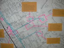
schmidt24133 viewsSanta Fe in El Cerrito; Schmidt Lane area Courtesy of Tom Panas
|
|
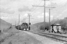
snunk54129 viewsBurton station. Located between Lafayette and St. Mary's. Date unknown. J.G. Graham Collection
|
|
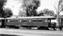
snmoraga14117 viewsSN in Moraga. Date unknown. J.G. Graham Collection
|
|
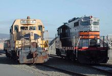
OTR4116 viewsOakland Terminal Railway power in February 2001. Courtesy of John Stashik
|
|
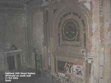
Interior014115 viewsOakland 16th St Station. SP herald on south wall. 10/21/04 Photo by Stash
|
|
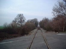
Clarksburg_Branch_Babel_Slough_Road_facing_Sacramento4109 viewsA view of the Babel Slough Rd. grade crossing, facing towards Riverview.
|
|
| 426 files on 12 page(s) |
 |
 |
 |
5 |  |
 |
 |
 |
 |
 |
|